Icarus GIS Virtual Machine
Tools

Website:
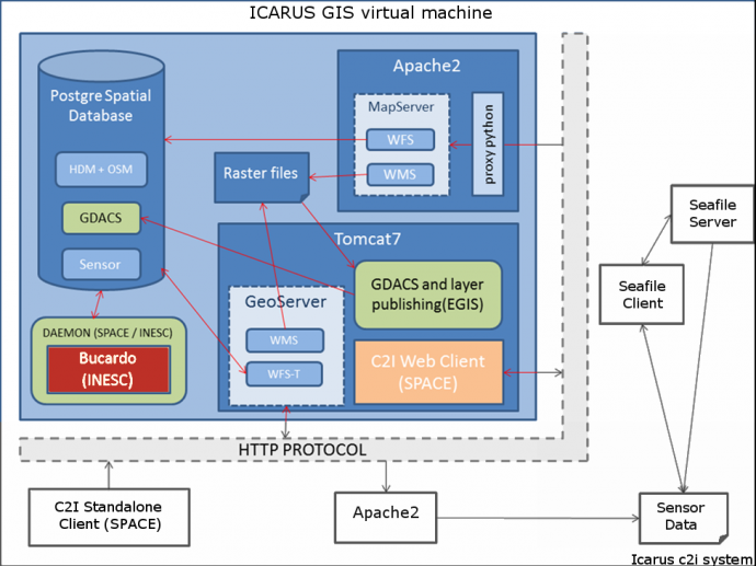
ATOS The ICARUS GIS virtual machine provides geospatial capabilities (sharing, visualization, processing and edition of geospatial data) and supports all C2I operations. The virtual machine is run on each C2I integrated laptop and is comprised of 4 main components that require specific configuration:
- Bucardo is a third-party replication system providing synchronization between all different C2I databases in real time. With such technology each C2I standalone or web client is able to display current situation having updates for every map change coming from the other C2Is.
- Geoserver is a GIS server that allows publication and edition of maps either in raster or vector format. It implements Open Geospatial Consortium standards such as WMS or WFS-T which allows creation, deletion, and updating of map features in the system. It also provides custom styling for the vector data.
- Postgres is a relational database providing data storage, including GIS vector data through a PostGIS plugin. The database mainly contains data from the platform sensors and OpenStreetMap data extended with Humanitarian Data Model.
- File repository containing a) different image data provided by different platforms and b) a service that allows the addition of new maps to the GIS server and their publication, either automatically or under request, during a rescue mission.
Related: