Rapid mapping tools, combining data from aerial and ground based assets
Tools


Website:
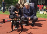
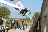
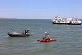
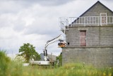
Unmanned Vehicle Center Accurate 3D mapping tools are provided by a number of service providers, relying on land-based (via a geodetic survey) or aerial-based (via manned our unmanned aircraft) mapping. Coming forth out of years of research on this subject in multiple research projects like ICARUS and TIRAMISU, the Unmanned Vehicle Centre is now able to present an integrated toolbox for combined ground and aerial mapping. Use this toolbox to bring together your environmental datasets, land-based and air-based. The UVC combined mapping toolbox will automatically align and match the datasets and create an integrated 3D model with enhanced accuracy.
Related: